SKYDATA
Assisting Tomorrow's Decision with Today's Intelligent Data
SKYDATA's History
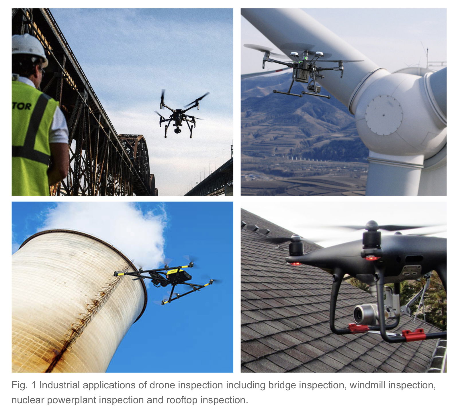
Industries as varied as Oil/Gas, Mining, Green Energy, Construction, real-estate, Environment conservation, Farming and so many more were all using specialized drones to acquire data set vital to their business - and were saving on cost to gather these data - Also saving big on safety by eliminating scaffolding, cranes, heavy equipments and required medical assistance on site.
Industries in South Korea, as well as Japan, were lowering their safety risk, specially in Non-entry /Hostile/ Confined environments scenarios cases. They were saving cost on inspections and streamlining abnormal events, like heat leak identification on office building or roof inspections. The prohibiting cost of such highly specialized drone, their regulatory and technical requirements such as personnel licensing, maintenance program and insurances, lead these industries to outsource their need for this type of aerial services.
In 2023, SKYDATA LLC was incorporated in Concord, NH - USA and headquartered in Nashua, NH. Bringing data gathering solutions to businesses and Agencies in New Hampshire.
SKYDATA's expertise
SKYDATA LLC is specialized in Unmanned Aircraft more commonly referred to as Drone Operations.
We are a DSP company, known as Drone Service Provider.
SKYDATA apply the safety and protocols in place in commercial public air transport to UAV operations - We manage and operate a fleet of specialized, high-tech, professional drones to help other businesses collect and analyze relevant data to unable strategic decisions makers to do their job.
From pipeline inspections in remote areas to urban land mapping for construction planning purposes SKYDATA can gather, and present readily readable set of data - or it can live feed data via secured link through the web for its client to visualize live data as the mission goes on helping direct and focus the mission's objectives in real-time.
SKYDATA - Keeping an eye on your assets.
Energy industry, Civil engineering, Construction planning and development, Urban mapping in 2D/3D for maintenance and development purposes, as well as high-risk inspections or investigation in Non-Entry areas, Hostile/Lethal environment, Confined space are SKYDATA specialties.
Our equipments and Remote pilots can safely acquire the data needed by our clients without the need to put human life at risk and at the fraction of the traditional cost by removing the need for heavy/costly tool, machines, or team member - no need of scaffolding, cranes, climbing equipments or Medic team at the scene - and doing that in a tenth of the traditional time usually required to get the mission done.
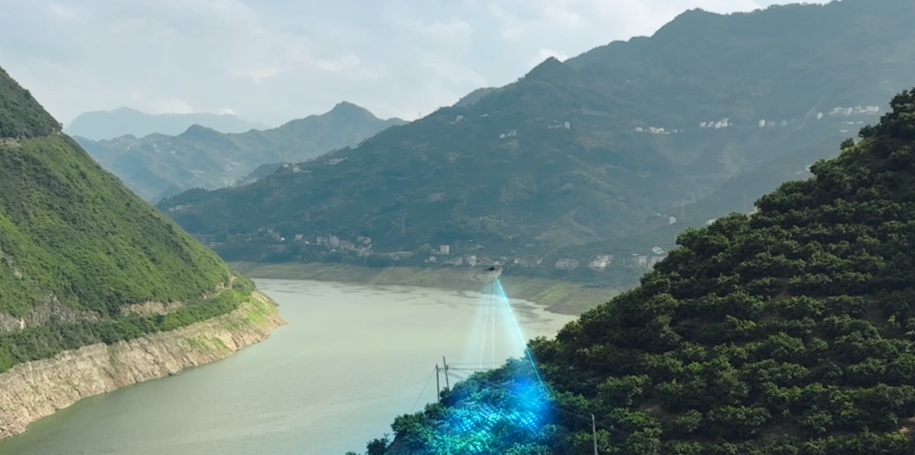
Power Grid Inspection
With SKYDATA's "per fight time use", monthly or even yearly plans our clients are saving the burden of investing into in-house drone program - Certifications, Safety protocols, Hardware and software, manpower, maintenances program, creation of official manual such as SOP or FOM Etc,. - and get the intel they need when they need it on a 24h/7 basis. We at SKYDATA remove the burden and give your business the dataset it needs to plan ahead or perform more efficiently. We do that at the fraction of associated cost of an in-house drone program. You can focus on your business and let us manage the drones and their incidental legals and technicals requirements.
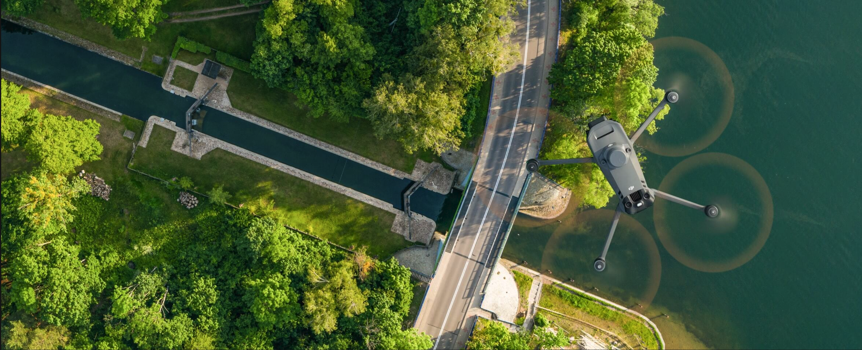
SKYDATA's fleet capabilities and payloads are aimed at industrial inspections and abnormal events, as well as land mapping and agricultural or conservation survey using sensors such as Thermal/ Infrared/ Multispectral/ High speed cameras/ LiDAR/ High Def Video Etc,. Some of our drones have "bad weather/ High wind" capabilities. We can gather, and transmit data beyond the 10Km/ 6.2 miles range, with the use of Visual Observers.
Water enrichment & Urban green area Survey
WE are also participating in the global effort for a greener world and a better way to manage earth resources - our specialized drone can also be used in environment and natural resource surveys, such as water enrichment monitoring, forest distribution surveys, urban green area surveys, and more.
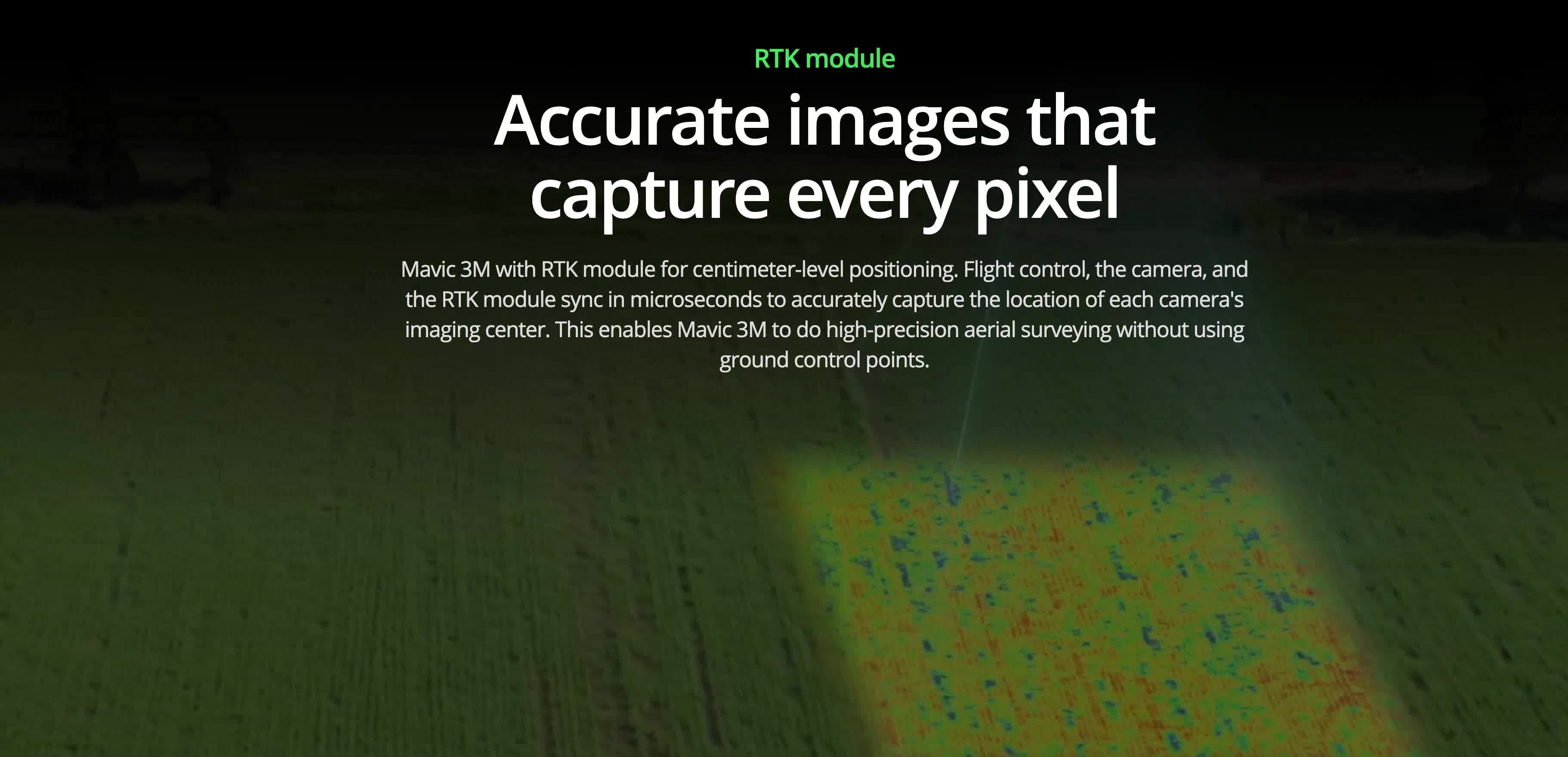
SKYDATA's Agriculture drone can delivers accurate pin pointed data to farmer and help decision making in pesticide treatment needs or seeds growth, Yield predictions and much more. RTK enable below centimeter precisions data acquisition - Satellite grade data at the fraction of the cost.
SKYDATA has been approved and received waver from the FAA to legally operate beyond the line of sight/ above 400ft. or even at night should the mission require it. We proceed on missions only after running risk evaluations protocols - and for complicated missions we simulate the mission before the actual flight takes place. Your business can get the strategic data it needs worry-free!
Topographic 3D Mapping
Learn more about why you should choose us.
You can download our tri-fold Brochure PDF version.
Why Choose SKYDATA?
We at SKYDATA LLC are taking all our missions with the seriousness and the discipline necessary to ensure the safe yet thorough data acquisition your business need to make strategic decisions.
We dedicate our team & fleet to cater and satisfy the need for strategic data stemming from variable entities such as States agencies, multinational corporations as well as small businesses with missions ranging from Assets mapping and assets inspection to non-entry environments and Natural resources survey or more simple missions such as real estate’s indoor/ outdoor video promotion for appealing portfolio and small business roof inspection for heat leak to maximize cost etc.,
At SKYDATA we execute each mission with the same precision and care and offer our clients the quality readily usable set of data they need to take business decisions. Safety and our clients needs always come first - we are dedicated to help our clients 24h/7. Our Remote pilots are trained in-house and follow strict protocols to collect and protect your data.
Choosing SKYDATA is the choice of professional for professional.
SKYDATA's Fleet

Specialized in 4k stabilized video indoor and outdoor with limitless possibilities.
Read More
Specialized in Inspections, land survey and mapping. The Mavic 3E is your ally in the sky.
Read More
Latest in the Mavic 3 Enterprise family - The M3M has a knack for green.
Read More
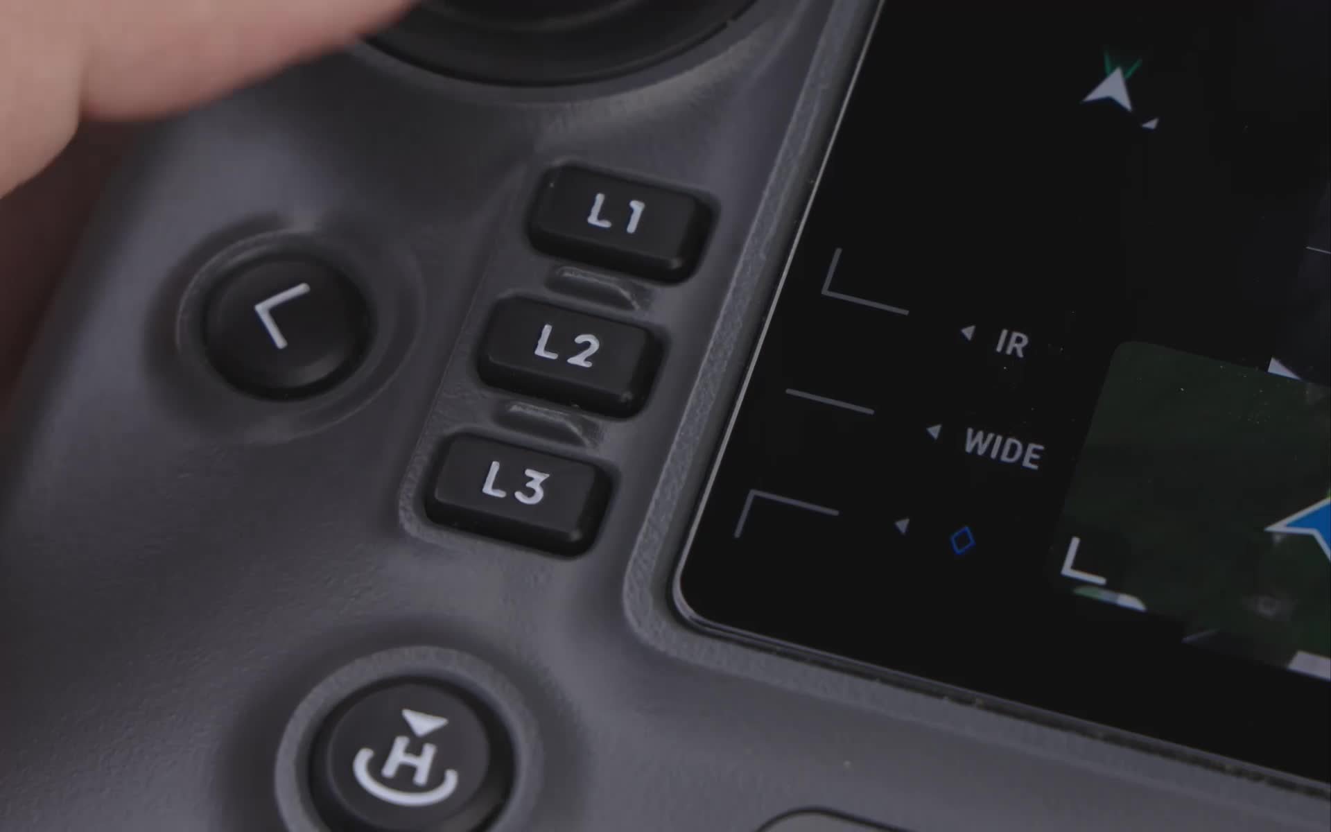
DJI Multi-sensors platform with bad weather capabilities.
Read More

SKYDATA's Team
Duen Sferrazza
Founder/ Managing Director
Duen's background in Multinational companies management is the foundation of SKYDATA - She has managed overseas US companies offices for the Asia region for over 20 yrs - from Civil engineering, to Medical, as well as leading global agricultural & food provider, Duen's true care for human resources and management has given her the required skill to create and lead her own company.
Stefano Sferrazza
Director of Flight Operations
As an active airline pilot & ground instructor on Airbus and ATR aircrafts, Stefano brings in a strong aviation background, including FAA Part 107 knowledge. Under the impulse of his wife Duen, he assisted her with the technical requirements of flying drones for commercial purposes and industrial applications. Stefano's focus is on safety, his aviation experience is a key-factor in supporting Duen's vision of the development and orientation of SKYDATA.
Your Picture Here
Associate Business Development
See our Careers pages for more informations and how to apply.
PARTNER


Indoor Drone Solutions
BUSINESS EVENTS
Your Business dinner or your annual convention recorded in 4k Stabilized video - Edition and presentation review to your complete satisfaction.
REAL ESTATE PORTFOLIO
Professional 4k video to showcase the latest asset addition to your agency portfolio. To make that property unique and appealing!
PROMOTIONAL VIDEOS
Your business wants to promote its new offices? Or maybe your company needs to promote the interior of its new plant to their customers with a stunning video ? Look no further our Avata has you covered.
Outdoor Drone Solutions
Thermal Inspection
Specialized FLIR & Thermal cameras for 8k Videos and micro-second still pictures, positioned to a below centimeter accuracy using Real Time Kinetic. Makes safer and cost efficient inspection routines and helping Decisions-makers, Managers and Engineers to act with confidence.
PHOTOGRAMMETRY
Construction site survey - Pre-planning /Follow up/ Post-planning. Natural resources survey, Land mapping and Topographic with survey grade quality - RTK enable cm positioning for accurate and professional results. 3D or 2D models that can be geolocalized.
LiDAR 3D MAPPING
3D LASER mapping of environments or assets with centimeter precision. Creation of 3D geolocalized models with below cm accuracy. Models can be manipulated with market software such as Autocad 3D - Helping engineers to plan their actions without leaving the office.
Packages
MISSION FLIGHT TIME
This is the most requested type of missions for unforeseen or abnormal events that requires an immediate investigation - Mission dispatch is made on a 24h/7 base provided drone aren't already assigned to scheduled flights. You Pay for the hours of FLIGHT not the data processing. CALL US TODAY to see how we can help your business to reduce operational cost and increase your growth.
MISSIONS BUNDLES
Days, weeks or longer bundles - Turn-key solutions that Includes everything for a smooth experience, from deployment to data processing and dataset handouts. Data can be delivered in-hand or remotely. Data collected are tailored for your needs according to your request. CALL US TODAY TO LEARN ABOUT HOW DRONES CAN HELP REDUCE YOUR COST!
CONSULTING
Your company can consult with us on how to start an in-house drone department. We will guide and provide you and your team with the required FAA documentations such as SOP/FOM and Train your designated employees to obtain the FAA Part 107 Commercial Remote Pilot Certificate. We will guide you on the type of drone appropriate to your operation and will help Registering your aircraft with the FAA - Give us a CALL TODAY !
Schedule Booking
Definitions
WHAT IS LiDAR?
LiDAR stands for Light Detection And Ranging - It is a detection system which works on the principle of radar, but uses light from a laser. The sensor emit pulses of laser and analyse the return - or bounce - of laser from the environment. It does not rely on the ambient light and can be used at night as well. It produce extremely accurate 3D Models that can geolocalized and accurate to below 1 cm precision and real-world measurement can be derived from these 3D Models.
WHAT IS PHOTOGRAMMETRY?
Photogrammetry is the science of collecting physical information from 2D photos, often aerial images captured by drones. By combining enough overlapping images of the same features, photogrammetry software can be used to generate photorealistic 3D representations of topographic surfaces.
Learn MoreWHAT IS THERMAL / FLIR?
FLIR stands for Forward-Looking Infra-Red camera and it is used to extrapolate thermal information from the environment. Common uses are for Thermal leak on building facade and roof - or to inspect heated elements such as electric pylons, etc.
Learn MoreWHAT IS INSPECTION & INVESTIGATION?
Inspection is the use made of drone to access assets and through sensors take video and still pictures to assess the state of the asset and plan maintenance program required. Investigation is made by drone to locate and help the analysis of malfunctions and help the decision making process by providing thorough informations. The use of drone is safer and more cost effective.
Contact us
- 1 Tara Boulevard, Nashua, NH, USA
- SUITE 200
- +1-603-800-4927 - Director of Flight Operations
- info@skydatausa.com
- Office Hrs: 0930H to 1830H Urgent: Call 603-800-4927 24h/7
CONTACT US - Our Director Of Flight Operations will be helping you with your request.